RiderInstinct Editorial Team
Why this matters: navigation decisions that affect safety and enjoyment
Navigation on a motorcycle isn’t just about finding a coffee shop—it affects how you ride. A navigation system that forces you to look down repeatedly, that loses signal at key turns, or that drains your battery can be a nuisance or a safety hazard. Riders must weigh trade-offs between convenience, ruggedness, and situational awareness.
Start by defining what you really need: simple turn-by-turn directions for commuting, a waypoint-based system for touring, or maps and trail routes for off-road adventures. That choice drives the rest: device selection, mounting approach, audio setup, and whether you need offline maps or cellular data. Throughout this guide we’ll build a decision framework so you can match features to real-world riding conditions rather than marketing claims.
How GPS and motorcycle navigation actually work — and their realistic limits
GPS navigation combines two things: a satellite-based positioning fix and map data (roads, points of interest and routing rules). The device or app uses satellites to determine your location, then compares it to map data to give guidance. Modern systems also use additional satellite constellations (like GLONASS or Galileo), cellular-assisted positioning, and inertial sensors to smooth fixes.
Practical limits riders should accept:
- Signal gaps: Metal structures, dense foliage, deep canyons and tunnels often interrupt satellite reception. Expect degraded accuracy or temporary loss and plan for it.
- Map data lag: Maps can be out of date—new one-way streets, construction or closed ferry ramps aren’t always reflected. For critical access (low bridges, legal closures, restricted roads), verify with local sources.
- Accuracy: Typical consumer GPS is accurate to a few meters in open sky, but accuracy degrades with obstructions. Don’t rely on GPS for centimeter-level positioning.
- Routing assumptions: General-purpose routing usually favors public roads and legal restrictions; it won’t know local off-road permissibility. Dedicated motorcycle GPS units sometimes offer motorcycle-optimized routes, but still verify the route’s suitability for your bike.
Navigation options and trade-offs for riders
There are four common approaches riders use. Each has pros and cons—pick based on your priorities.
- Smartphone apps (Google Maps, Waze, Komoot, Kurviger, etc.): Pros are huge app ecosystems, easy address input and fast updates. Cons include exposure to weather, limited ruggedness, visibility issues in bright sun, and variable motorcycle routing fidelity. A quality mount, weather protection and a plan for charging mitigate many issues.
- Dedicated motorcycle GPS (rugged zūmo-style units): These are designed for vibration, weather and glove use. Pros: motorcycle routing, glove-friendly buttons, integrated mounting kits and often better sunlight-readable screens. Cons: cost, fewer app integrations, and periodic map purchases or subscriptions.
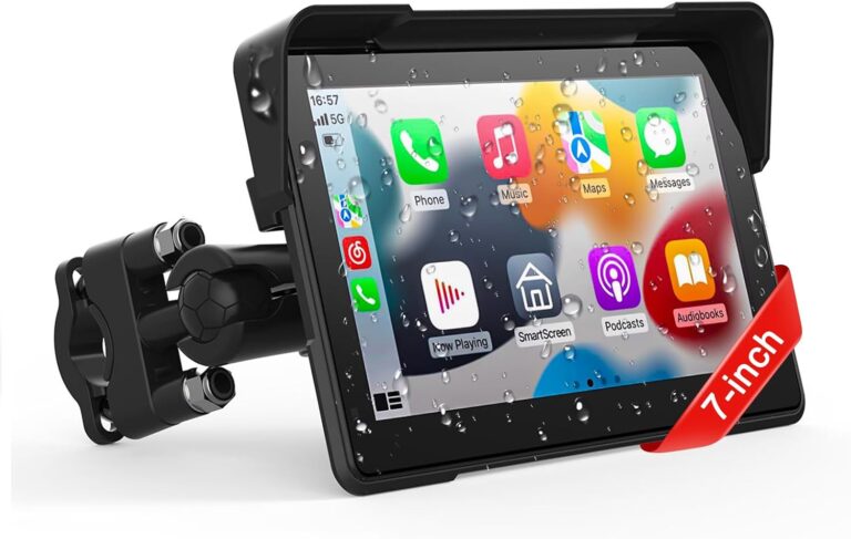
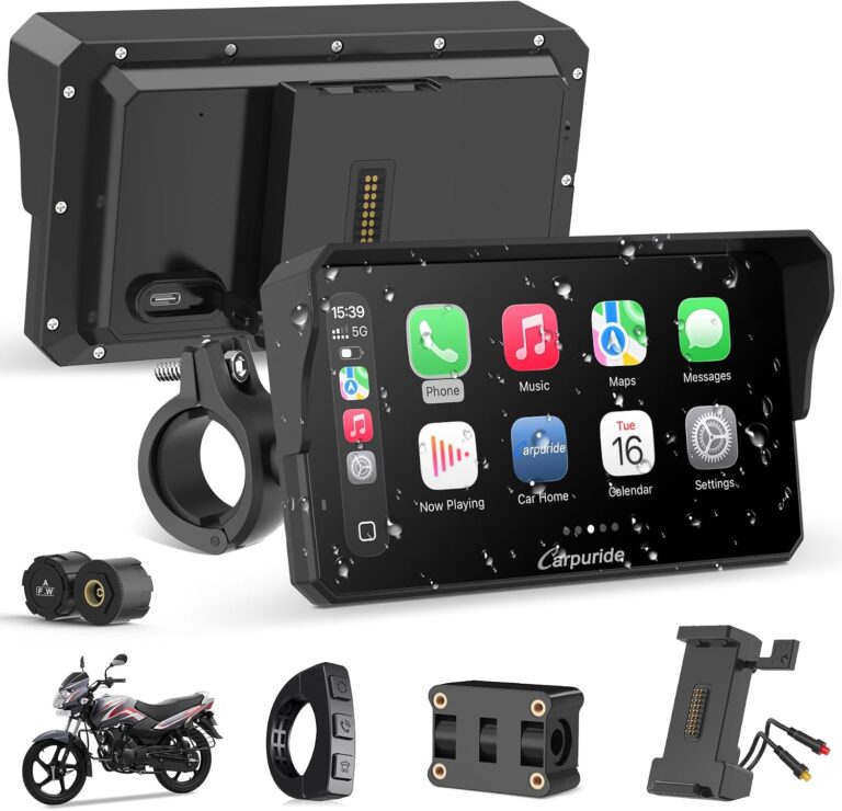
- Integrated in-dash screens / CarPlay / Android Auto: Some modern bikes support integrated screens or aftermarket CarPlay/Android Auto boxes. Pros are large displays and seamless phone integration. Cons include installation complexity, potential incompatibility, and reliance on your phone’s routing behavior.
- Helmet HUDs and dedicated navigation wearables: Emerging solutions provide heads-up cues. Pros: minimal head movement. Cons: limited map detail on the fly, battery and pairing concerns, and higher cost for the convenience.
There’s no single “best” approach—commuters and urban riders often do fine with a phone + mount, while adventure riders may prefer a dedicated GPS for weatherproofing, dedicated routing features and offline maps.
Mounting, power and weatherproofing: practical installation guidance
How you mount and power your device matters as much as the device itself. A loose phone or intermittent power tends to ruin a ride.
Mounting tips:
- Use a reputable motorcycle-specific mount and secure all fasteners. Handlebar mounts, fork-stem clamps or bar clamps each have different vibration and sightline properties—test them and use thread locker on metal-to-metal fasteners when appropriate.
- Position the screen so you can glance without changing body position. Avoid blocking instrument clusters or lights. Check local laws about obstructing your view or handlebar controls.
- Consider anti-theft: quick-release systems or remove the device when parking in public. For permanent installs, conceal mounting hardware and power wiring when possible.
Power options and best practices:
- Prefer permanent fused accessory power from the bike’s battery or accessory feed for long rides. If you’re uncomfortable, have a professional install a fused power tap or use an accessory relay.
- Use waterproof inline connectors and grommets where wiring passes the frame. Secure cables with zip-ties and leave a little service slack near steering to avoid pinching when turning.
- For phones, a dedicated USB power port or USB-C fast charger is useful. If relying on a battery pack, secure it in a tank bag or luggage—not dangling on the bars.
- Protect the device from heat sources (exposed exhausts or prolonged sun) and from rain. Even “weather-resistant” devices benefit from a protective case or a cockpit bag in heavy weather.
Always consult your motorcycle’s owner manual before tapping into electrical circuits and verify fuse sizes and load limits when adding accessories.
Routing choices for riders: how to plan safe, enjoyable routes
Not all routes are equal for motorcycles. Think about surface, traffic, altitude, and the kind of ride you want.
Practical routing tips:
- Choose routing mode to match the ride: If your app or GPS offers “curvy roads,” “scenic,” or “fastest,” understand that “scenic” may send you on narrow, slow roads and “fastest” will favor highways. For leisure rides, prefer routes that avoid uncontrolled intersections and busy highways.
- Preload waypoints: Load critical turns or waypoints into your device before you leave. This minimizes on-the-fly address entry and gives you a clear plan for complex junctions.
- Check elevation and grades: For heavy or luggage-laden bikes, steep grades and tight switchbacks may be impractical—check the ride profile if your routing app shows elevation.
- Verify off-road legality: If you’re planning gravel or trails, verify whether motorcycles are allowed. Mapping apps do not always reflect land access rules or seasonal closures.
- Plan escape routes: Know alternate ways back to major roads in case a segment becomes impassable or the weather turns.
Pre-ride route checks—look at the whole ride at low zoom to understand the context, then zoom in on tricky segments. This habit prevents surprises like one-way systems or missing bridges that sometimes crop up on unfamiliar roads.
Audio cues, helmet integration and group riding
How your GPS communicates directions is a safety-critical detail. On a bike you should minimize time spent looking at the screen.
Options and recommendations:
- Voice prompts: Strongly preferred. If your helmet supports Bluetooth intercom or stereo, pair your phone or GPS for spoken directions. Set volume levels so prompts are audible over wind noise without masking critical environmental sounds like horns or emergency vehicles.
- Vibration or tactile cues: Some smart devices and wearables can use vibration patterns for turns. This reduces visual distraction but requires training to interpret reliably.
- Visual simplicity: Configure maps for simple turn arrows and minimal clutter. High-contrast modes help in bright sun. Reduce map animation to avoid distracting movement.
- Group rides: For group navigation, use route sharing or publish GPX tracks to the group before leaving. Decide whether the lead will be the canonical navigator or if everyone follows the same file—clear communication prevents split-ups and risky maneuvers.
If you use an intercom system, verify compatibility with your navigation device before buying. For phones and CarPlay-style integrations, test audio routing at low speed in a parking lot to confirm prompts are routed and audible.
Offline maps, caching and data plans — staying navigable without cell service
Rural and remote riders often need routes where cellular coverage is limited. Offline maps and GPX files are your safety net.
Best practices:
- Download whole-area maps before your ride: Most navigation apps and dedicated GPS units allow you to download regional maps. Do this over Wi‑Fi and verify the download completed successfully.
- Carry a GPX backup: Export a GPX route to a secondary device or your GPS unit. A second device lets you continue if your primary fails.
- Battery management: Offline navigation still uses the device’s battery for GPS and screen. Bring a dedicated power source or use a permanent power tap if you expect long days in the saddle.
- Plan for redundancy: Consider a small physical map and compass for long remote rides—GPS is reliable but not infallible.
Test offline navigation before relying on it in remote terrain. Open the map area on your unit, simulate route segments where possible, and ensure turn cues work without cellular data.
Troubleshooting common GPS problems and simple fixes
Common navigation problems are usually solvable with a few checks. Here are scenarios riders frequently encounter and straightforward remedies.
- Intermittent signal or “off-road” positioning: Pause in an open area to allow the unit to reacquire satellites. Restarting the device can clear a stuck fix. If the problem persists in multiple open locations, check for antenna obstruction or a damaged mount.
- Voice prompts not heard: Verify Bluetooth pairing, audio routing, and in-helmet volume. Some units have separate voice guidance volume and media volume—confirm both settings.
- Device reboots or freezes: Make sure the unit has a good power connection and that the battery isn’t failing. Install firmware updates from the manufacturer—and follow their instructions carefully.
- Map mismatches: Check for available map updates. If a route takes you onto an unexpected road, pause and consult the overview map at lower zoom before proceeding.
- Phone app reroutes too aggressively: Many apps try to quickly correct for missed turns. If you prefer to return to the original route, change reroute settings before you leave or manually rejoin a saved GPX track.
When a problem involves wiring, fuses or the motorcycle’s electrical system, stop and consult a professional if you’re unsure; improper wiring can cause battery drain or damage electrical components.
Privacy, trackers and sharing routes: protect your location
Location tools like tracking devices, live sharing and cloud-synced routes make it easy to get help, share adventures and review rides. They also carry privacy trade-offs.
Practical privacy guidance:
- Understand sharing settings: Live-tracking features and location-sharing links often default to being visible to whoever has the link. Use private sharing and expiration settings when available.
- Secure accounts: Use strong, unique passwords and two-factor authentication where offered. Review connected apps and revoke access you don’t recognize.
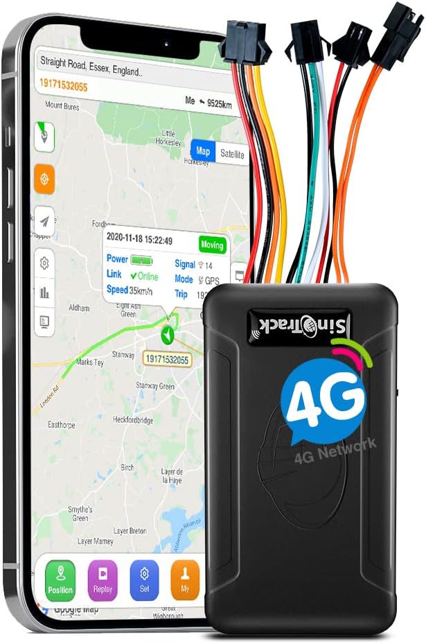
- Trackers: GPS trackers (battery-powered or wired) can be useful for recovery if a bike is stolen. If you plan to use a tracker, verify service model (subscription vs. no-subscription platforms), location accuracy, battery life and platform privacy before buying. For example, RiderInstinct has product guides and reviews that can help you evaluate options.
- Think long-term: Publicly posting your habitual routes or daily location patterns increases risk. Consider delaying public sharing of touring logs until after you return home.
How to choose — a practical buying and setup checklist
Match the device to your riding style and then verify mounts, power and audio. Below are specific criteria to weigh before you buy and immediately after you install.
Where to learn more: RiderInstinct’s GPS & Navigation Buying Guide provides a structured approach to compare features like routing modes, screen size and ruggedness. If you’re considering a dedicated motorcycle GPS, see our Garmin zūmo XT2 review; for phone-based setups, the motorcycle phone mount review covers durable mounting options. If you want both tracking and location security, check our reviews of SinoTrack GPS tracker products for details on subscription models and installation considerations.